
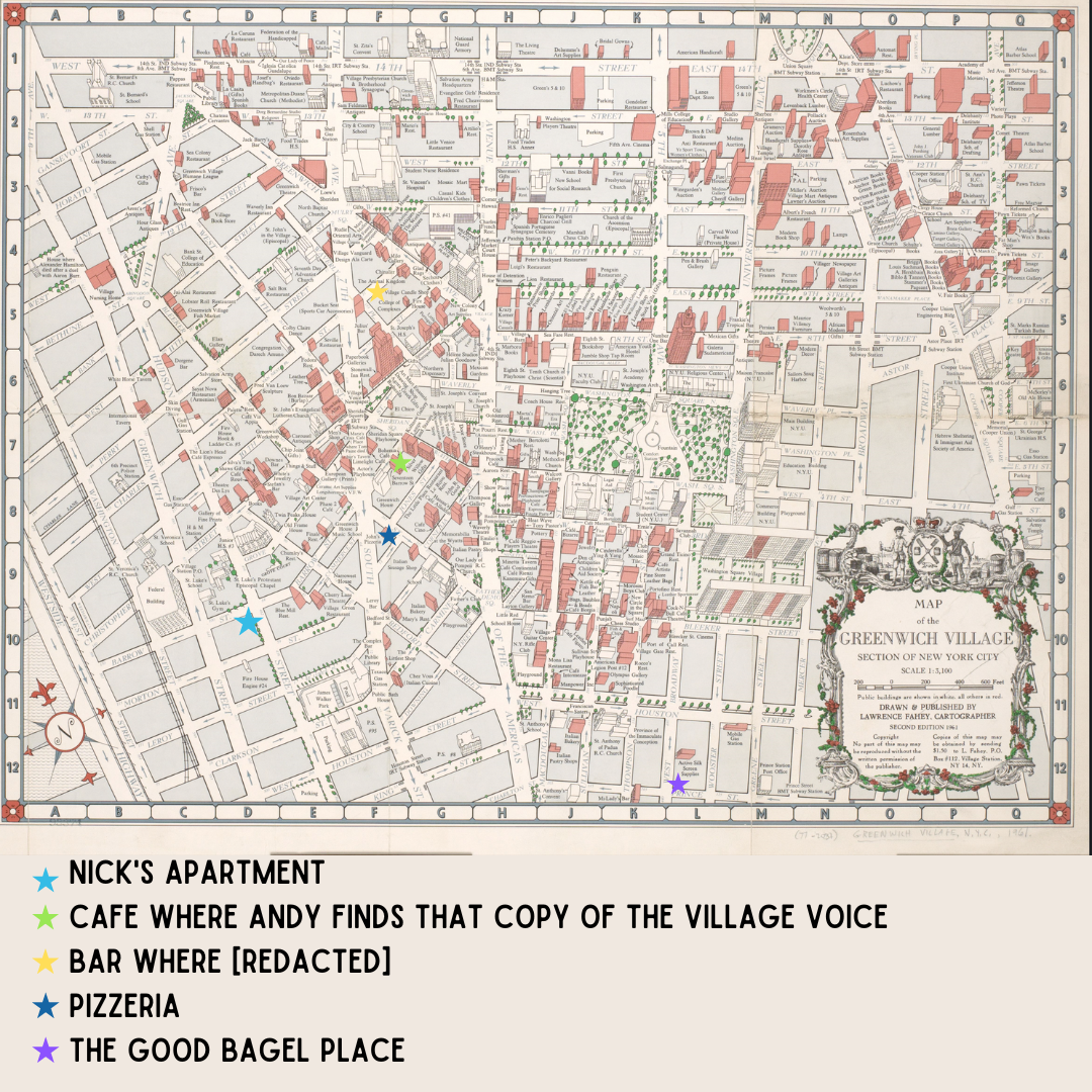
While I was researching We Could Be So Good, I ran across this tourist map of the village. WCBSG is set in 1959, and this tourist map of the village was published in 1961, but it’s close enough! I kept it open in a browser tab pretty much the whole time I was writing the book.
I’ve labeled some of the major locations, and if you look closely you can see other places that feature in the book–Italian bakeries, a florist, a bookstore, etc. A couple of places that figure in queer history are also on the map, including Julius’ and Stonewall. The Women’s House of Detention is also there.
The only major location in WCBSG that isn’t on the map is the Chronicle building, mainly because the Chronicle did not exist, but also because the Chronicle building in the book is outside the bounds of this map (it’s in the old Sun building near City Hall, on the corner of Broadway and Chambers).
If this era interests you, or if you just like maps, the original is a delight: https://digitalcollections.nypl.org/items/8f371ee3-2a53-9744-e040-e00a1806601e
